Friday September 2nd, 2010
Greetings and welcome!
We have a few things to update today. Yesterday’s report is below.
First up, the rain yesterday.. Yesterday’s rain came in two main waves. The second one started about dinner time and was the bigger of the two. The rainfall added up to between 0.8″ and 2.0″ according to the various gauges and radar returns. We got pounded pretty good here, but my bucket was not reset, so I don’t have a good tally.
Today is cool and breezy with a mix of clouds and sun. Right now we are just over 60F. The wind changes moment to moment, sometimes calm, sometimes gusty. Athelstane Weather did record a gust of 35 at some point today. The wind and chance of rain remains through this evening, but the strongest of the storm has passed.
The storm has continued to strengthen as it moves away and picks up the energy from the hurricane. The models are showing it getting down to a 980 central pressure at it’s peak, a very strong storm. Some people on the east coast and eastern half of Canada are not going to have a nice weekend for weather. Thankfully we got in on it early and it will be well to our east and north.
Things look a little better for the weekend than they did. The forecasters have moderated a little in their temperature predictions, and now we are looking for mid-60s Saturday, about 70 Sunday and mid-70s Monday. Low temps are also up a little in the forecast. They did enter a chance of rain on Monday, but from my research that looks minor until late in the day.
The rain has also given the whitewater rafting a nice boost. The Peshtigo came up to almost 200cfs, and based on how much rain we had and where it hit in the watershed, it should rise more over the weekend. A rising river is a fun river, and that is my prediction.
Along that same line, the rivers that flow to our waterfalls will benefit from the rain, so a waterfall tour is on the list of recommended activities.
Don’t let the cool start to the weekend throw you. It is not as bad as it sounds. There is a storm hot on the heels of this one that will bring rain Monday night. In advance of that storm we will see the winds shift from the northeast to the west and southwest and it will warm things up a little as the weekend progresses.
Sunny 65 for Saturday and 70 for Sunday sounds good, and so does increasing clouds and mid-70s for Monday. After tonight I am really expecting a really nice weekend. Saturday is probably the most notable-when some wind and a cool day meet the sunset under a clear sky, it will cool off.
With the cool day outside I am off to go and tackle a bunch of projects that I put off in the heat & humidity that we recently enjoyed. It is perfect weather for outside work, I can wear long pants, but don’t need a jacket, and the wind will cool me off as I work.
Have a good weekend and thank you for visiting!
RJB
Thursday’s Update
Today I have more than 15 minutes to work on my report. My apologies for Tuesday’s hit n run.
It is rumbling outside as of 10:30 this morning, and we have had some decent waves of rain in the last hour or so. The storm that it is associated with will bring us rain ahead of the weekend, but is not expected to linger into Friday night or Saturday.
The storm itself is interesting. It is a big one with Gulf of Mexico moisture support and plenty of cold air for temperature contrast. It is strengthening as it passes over the UP and Lake Superior on its journey NE.
The temperature gradient is what catches my eye this morning. On one side of the storm we have 3ºC air up in Canada. On the south and west periphery of the storm temps are 21ºC, and on the east and south edges, 15-18ºC. That is a lot of temperature contrast, so there should be a lot of energy associated with the storm, especially when the hurricane joins forces with the low off of the east coast Friday.
The end result for us looks like rain now through Friday, followed by a cool weekend and some wind. As the storm passes, we will get some of that Canadian air. Friday night the maps are showing me 0ºC 850mb level temps, almost cold enough to snow (-4ºC) in the upper atmosphere.
The end result? Friday night’s forecast from the NWS is for lows in the middle 40s, with northwest wind 15 to 25 mph decreasing to 10 to 15 mph after midnight.
Saturday we are looking at highs in the low to mid-60s, again with 10-15mph winds. Saturday night should bring low 40s, and Sunday should bring a high of about 70. Look for upper 40s Sunday night and mid-70s Monday.
So, if you are planning outside stuff for this weekend, it will be nice, but on the cool side. It will be warming as the weekend progresses but bring fall gear as well as summer stuff.
A couple of thoughts on the storm.. One.. If it were January it would be a classic winter storm. Warm in front, starts with rain and changes to snow, followed by some wind and cold out of the northwest. I’d guess it for 6-8″, maybe more.
Two.. The contrast in temperatures had me running the AC a little while last night to get rid of the stickiness, tomorrow night I’ll be rolled up in the blankets. I guess that temperature diversity is why I have so much stuff in my truck like shorts & Repel, plus long pants and a jacket. I took the mittens out in July.
Tuesday night I was out and spotted my buck again. He was a mile north of where he was before, and this time ran along the side of the road. I got another good look at him, and he was a pretty decent deer.
On the way back I ran into a line of showers and storms, or more accurately, two of them. There were a couple of lines of heavy rain and thunderstorms Tuesday night. They did not last long, but it was a good sky show. Area stations reported <1/4″ rainfall totals.
I was cleaning up my movie computer the other day and ran into some pictures that I never posted. This was the summer of the mushroom in my travels. July in particular had a lot of wet weather, and it was not lost on the world of fungus. Several times after taking pictures of a raft trip I would see how many different kinds of mushrooms I could photograph in the 1/2 mile or so walk back to the truck. This slideshow is from a single walk on August 1st.
(Click a picture to make it bigger, then hover your curser on the left or right side of the picture to advance to the next slide)
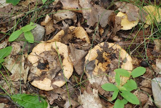
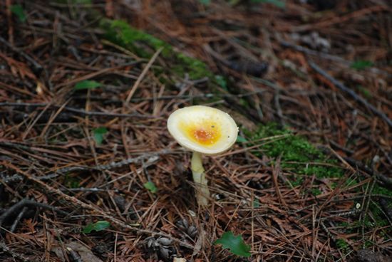

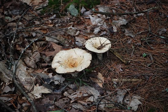
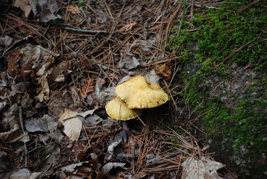
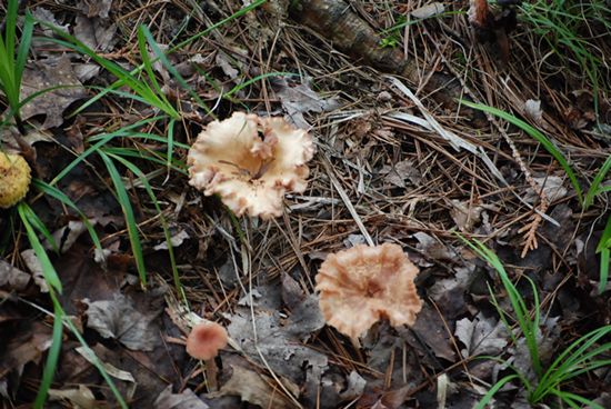
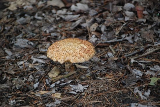
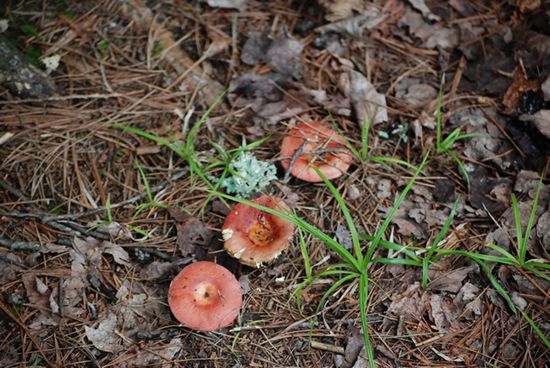
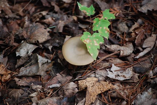
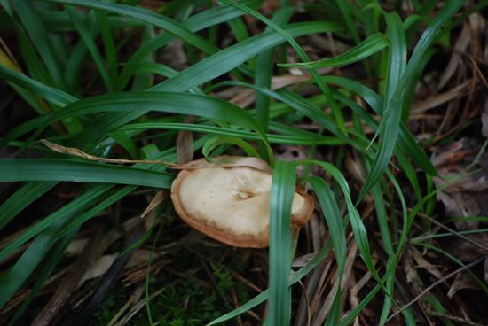
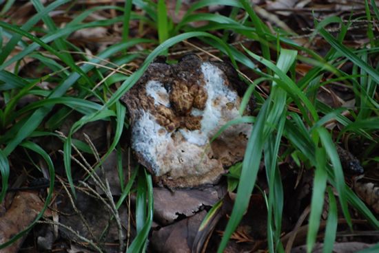
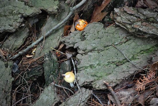
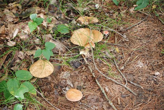

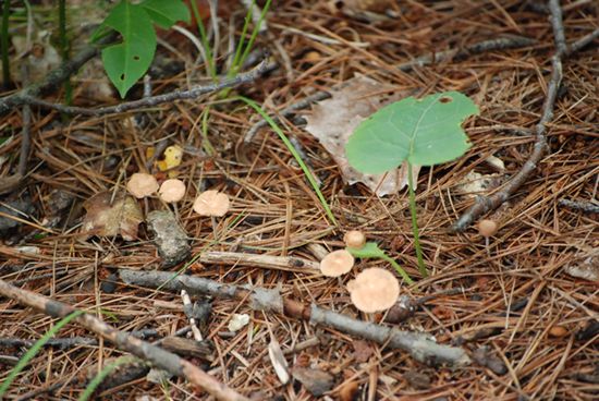

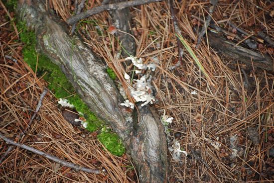
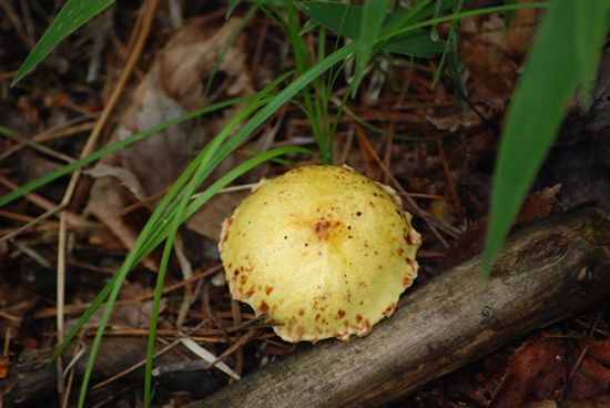

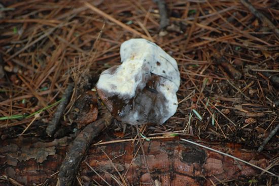
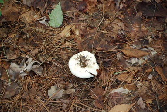
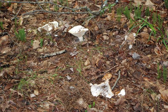
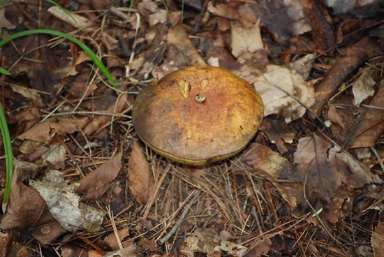

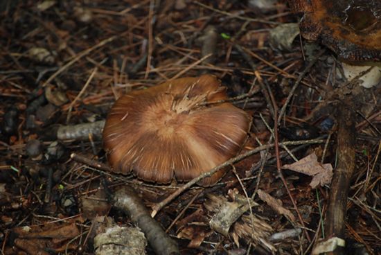
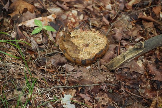
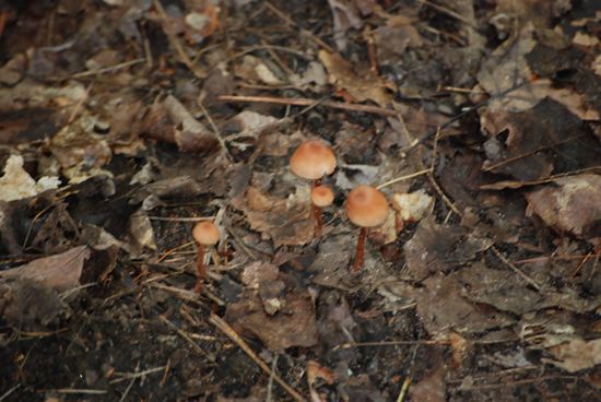

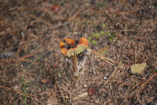
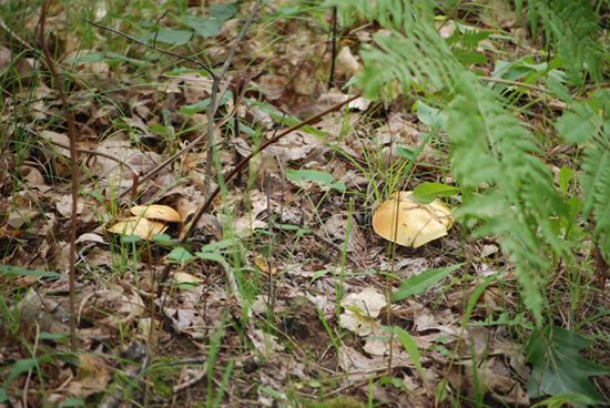

That is pretty amazing for a 1/2 mile walk in the woods. I thought maybe it was from a couple of them, but no, the file numbers are continuous. Yes there are several repeats, but still it is a lot of variety.
That is about it for today. Have a good weekend and thank you for visiting!
RJB