2013

Wed 8-21-2013

I was watching the storm come in on radar and thought I’d go and get in front of it and do some big wall cloud and lightning shots from Landing 8 on Caldron Falls Flowage.
The storm promised to be a good one, and I was watching the Doppler radar closely for cloud rotation, shear, and other warning signs. It looked like a good storm, but not dangerous. Doppler can kiss my ….
I left in the first rain heading east from my house near C & F in Silver Cliff. I got to the S curves just past Rustic Inn and it got ugly. I came around the eastern most corner by the old riding stable and started wondering if I was driving into a rain wrapped tornado. The wind was throwing the car all around and I was doing about 5mph due to zero visibility. The rain and hail was so fast that there was a half inch of rain on my windshield immediately behind the wiper on high.
I stuck it out at a crawl until Jungle Jim’s and pulled in there. The parking lot had about 6-8″ of water, and a gushing stream pouring into the parking lot from the ATV trail.
When it let up I went east toward Red Pine BP. The ditches in front of the church were full and running over their driveway, and the yard across the street was flooded. There was a tree down just east of the church, and another a few doors east on the north side of the road.
The gas station was out of power. I headed south on Parkway to survey damage. There were a lot of small branches in the road. The guy with the white mobile home and the permanent rummage sale lost about 5 big trees. There were a few trees partially across parkway past that and a lot of branches.
I got stopped just south of H & S Lane by some trees across the road between there and the 359 degree corner on the Silver Cliff/Stephenson line. An hour later it was still blocked.
On the way back I saw that the guy with the old riding stable by Bella Riva had some big trees down, and one crushed a car.
Heading south on Landing 11 Rd later there were a lot of small branches in the road, and a couple of trees across the road south of the boat landing. Between the pipeline and the paved road on Landing 11 had varying amounts of branches in the road and a few downed trees. Caldron Falls Rd had a few small branches. I moved a few small trees off of Ranch Rd right by the swampy S-curves just west of the park.
That was pretty much it for my travels, it was dark by then.
Some really nice campers at Kosir’s showed me a very funnelish looking cloud picture that they took right before they headed for shelter. It looked pretty real to me, especially after driving though it.
The storm came through right before sunset. Between blocked roads and the setting sun I can only tell you the little bit that I experienced, that I offered above.
My impression was that it was a wicked storm, but only in spots. My little Ponderosa was untouched, my neighbor’s campers 600′ east got their awnings shredded. It was very hit and miss, but where it hit, it was pretty real.
I am planning on checking people’s places tomorrow morning with the truck, straps, and chain saw. If you want me to check in on your spot, let me know. I am glad to do it. I know how much I worried about my place when I still lived in MKE.
I would say that there is an 95% chance that any given place survived the storm intact. A few took a hard beating, most didn’t.
If you want me to check your place around Silver Cliff, let me know through FaceBook, email me at rayb@cybrzn.com, or leave a comment.
Friday, August 9, 2013

Greetings & Welcome!

This is the weekend of the Silver Cliff picnic and parade. The parade starts at 10am at Boat Landing 11 Rd and makes its way to the picnic grounds at Parkway North (Hwy I)  and Hwy C about an hour later. The picnic will feature raffles, horseshoes, food and drink, crafts, fire department water ball fights and equipment displays, and much more. It benefits the Silver Cliff Fire & Rescue Auxillary, who in turn supports the departments in many ways. It is an old fashioned small town picnic and parade.

Wildlife sightings this week included three different turkeys between here and Lakewood, and all had a flock of little ones following along. On the way back there were a couple of sandhill cranes a little west of Waubee Lake.

I have an interesting challenge ahead of me. There is a paper wasp nest under the back step about the size of a cantaloupe. The challenge comes in that the nest is behind the support joist, and I pretty much have to lay down about 2′ away to hit it with the bee freeze. I am not really liking that idea too much, thus the challenge. It is a dicey little situation without an easy answer. I welcome ideas.

Right now I think that my best option is to buy a beekeepers hat, net, and protective gear.  Eradicating the wasps and hornetsis an annual summer ritual around here, it might be handy to have the right gear for the job. I had 5 nests on my land when I surveyed it this week, now I am down to three, two of which are tough to reach.

The storms that came through Tuesday night started out as pretty normal thunderstorms. They dropped 0.5-2″ of rain according to radar returns. The Peshtigo River watershed got hit pretty good, and the river is running above normal this weekend.

The storms took forecasters by surprise when they grew into severe storms that ended up with straight line winds that measured over 85mph and spawned something like 6 tornadoes. They were not expecting severe weather out of it.

It didn’t get severe until it was south and east of our area, and the really heavy stuff was down by Green Bay and points south.

There was one fatality from the storm when the Town of Porterfield Town Chairman was hit by a car while clearing a downed tree from the road. High winds and heavy rain limited visibility, along with the headlights from his car. Our thoughts and prayers are with his loved ones.

The storm brought up a discussion on the morning news about how the NWS determines of damage is caused by a tornado or straight line winds. The answer is in the damage path. Straight line winds tend to push debris away from the downburst, tornadoes tend to gather debris toward the tornado site.

As you probably saw, I was up early Wednesday morning with an update letting people know that this area fared ok in the storm. I will always do that in heavy weather if it affects our area. I know how worried I used to get when I lived in Milwaukee and a big storm came through up here. I have a generator for power outages, so unless the cell towers that bring my internet are down, I will be on it.

Beyond that I don’t have a lot for my update this week. I mostly worked and didn’t get the chance to get out much. Hopefully next week will bring a little time to go and adventure a little.

Have a good weekend and thank you for visiting!

RJB
36th Annual Silver Cliff Fire & Rescue Aux. Picnic – Silver Cliff Memorial Picnic Grounds
Parade at 10 AM – Picnic from 11 am – 6 pm  – Food & Drink, Games & Raffles, Fun for the whole family

Wednesday 8-7-2013

Storms were NOT severe here

6:30am-

Greetings and welcome!

A line of severe thunderstorms blazed through northeast WI last night. They brought hurricane force winds of up to 85 mph, and several suspected tornadoes closer to Green Bay, in the Fox Valley, and east toward the lake shore. Something like 50,000 people are out of power. They are still assessing the damage now that the sun is rising.

When the storms went through my neighborhood here in Silver Cliff they were NOT severe. There was a little lightning and I fell asleep to the rain pounding on the roof, but there were no high winds. I have a couple of trees with a lot of dead branches, and they did not drop a single one.

The local rain gauges at the USGS station by Kosir’s and at Athelstane weather are only showing a couple of tenths of an inch of rain. It seemed like a lot more than that. It was pounding on the roof for quite a while. Radar returns indicate 1/2″ of rain in the area, and that was before I fell asleep to the rain on the roof.

The southern 2/3 of Forest Co saw 1/2-2″, with most seeing at least an inch according to radar returns. That would be the Peshtigo River watershed, so it could bump water levels up for the weekend.

Anyway people with property in the area will be happy to hear that the weather was not severe here. I wanted to get that out ASAP. There were a couple of reports of wind damage near Marinette and in far southern Marinette Co down by Hwy 22. I will look into those as info becomes available.

RJB

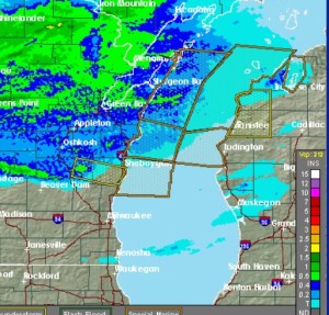
Radar estimates of rainfall as of about 11 or 11:30 last night.

8-7storm

Saturday 8-3, 2013

Golly did I drop the ball on one of my events. Rusticfest is tonight at Rustic Inn on Hwy C 1/4 mile west of the Peshtigo River by Kosir’s. They will have a band playing outside called Around The Horn, and off shoot of the Mullens Family Band. There will be brats and burgers on the grill, and there isn’t a cover. Not sure how I missed that a mile and a half from the house.