2014

4/15/14 Tuesday Night

Greetings and welcome!

It looks like we have some weather headed this way. There are winter storm warnings for Forest Co and points north and west. They could see 9-14″. Farther south and east we are under a winter weather advisory with 4-8 possible.

Looking at the forecast models, the ones that I use all agree on a three day precip total of 0.75-1.0″, and the GFS adds 0.25-0.5″ from about Wabeno north and west. Using a basic 12:1 ratio on rainfall equivalent, we are looking at 9-12, and likely a lot more north and west. (That seems a little high, but it is what the models say..) On the HPC QPF one spot about halfway between Eagle river and the Mississippi was pegged at 1.26″, suggesting 14-15″ of snow.

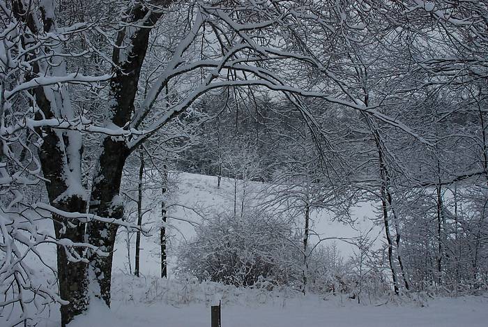
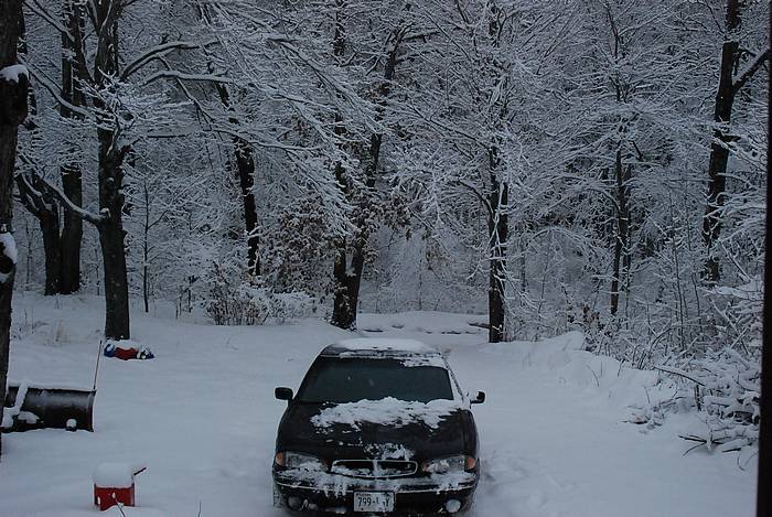
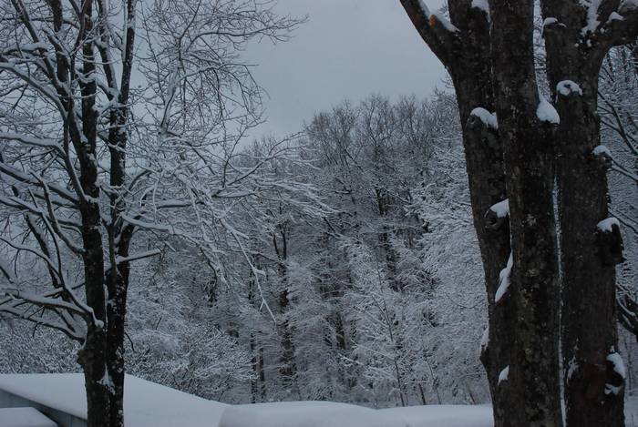
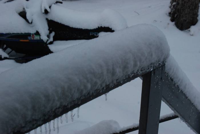
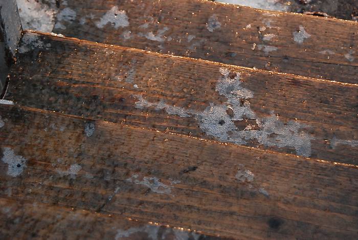
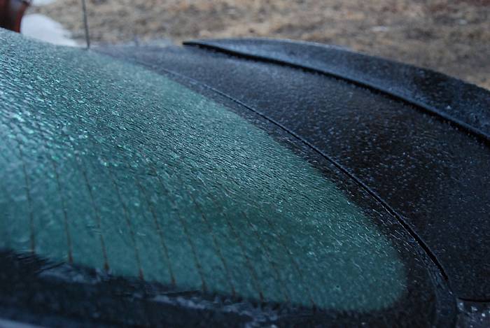
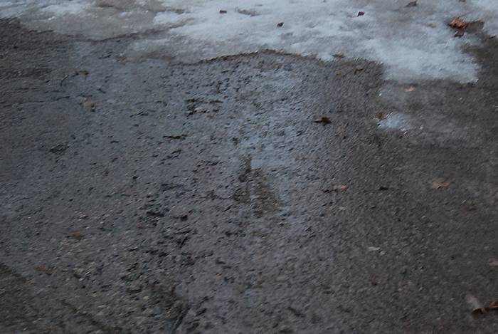
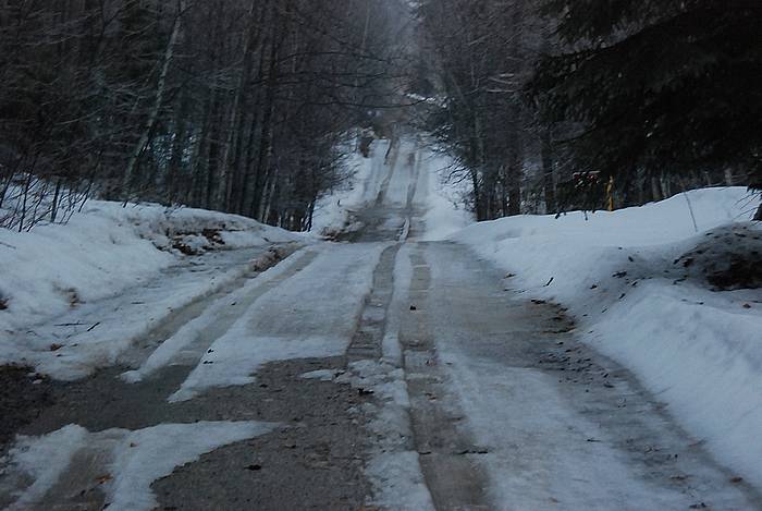
We had a very cold night last night and a very cold day today. There was still 2″ of snow on the ground when I was out fetching some firewood at sunset. It is pretty unusual for snow to last a day in mid April, but it was cold enough that there wasn’t much melting.

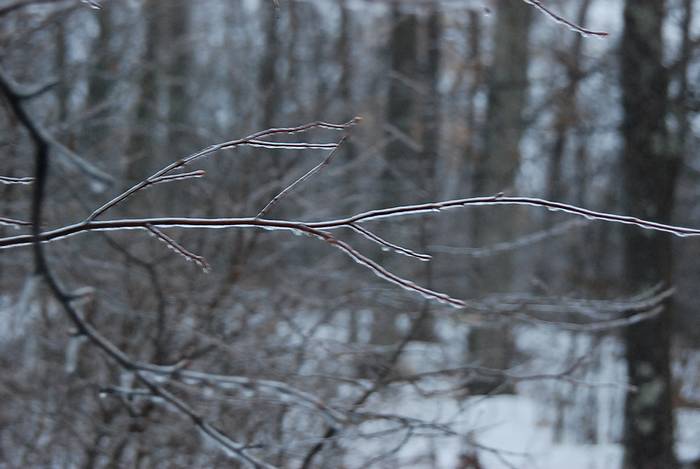
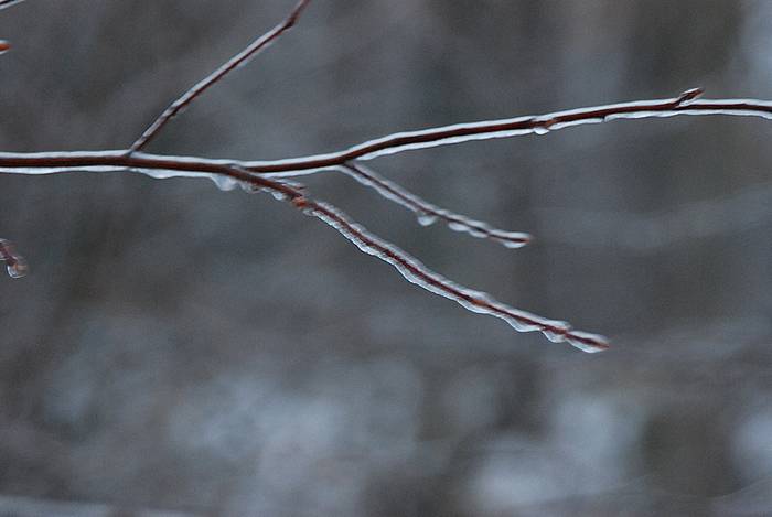
We had mixed clouds and sun, along with strong gusty winds. There were some big clouds getting blown in from the northwest, and you could see the snow falling out of them at a distance. It was pretty. On the ground, it meant sun one minute, and blowing snow the next. The snow didn’t accumulate, but it was an interesting day in weather.

Tomorrow promises to be interesting too. The way that it looks now, the snow will start mid-morning, add up a little before taking a break, and then a lot more snow late day and overnight.

Below are the current advisories and warnings as of 10pm Tuesday night.

Have a good Tuesday and thank you for visiting!

RJB

RJB

Winter Weather Advisory

URGENT - WINTER WEATHER MESSAGE
NATIONAL WEATHER SERVICE GREEN BAY WI
852 PM CDT TUE APR 15 2014

...LATE-SEASON SNOWSTORM EXPECTED TO HIT NORTHERN WISCONSIN
WEDNESDAY INTO THURSDAY...

.LOW PRESSURE DEVELOPING IN THE LEE OF THE SOUTHERN CANADIAN
ROCKIES WILL TRACK TO SOUTH DAKOTA BY WEDNESDAY MORNING...THEN
TO LAKE MICHIGAN BY THURSDAY AFTERNOON. PLENTY OF COLD CANADIAN
AIR WILL REMAIN IN PLACE NORTH OF THE TRACK OF THE LOW...SO A
SIGNIFICANT SNOWFALL IS EXPECTED ACROSS FAR NORTHERN WISCONSIN.

WIZ013-018-019-161000-
/O.CON.KGRB.WW.Y.0015.140416T1500Z-140417T1500Z/
NORTHERN MARINETTE-LINCOLN-LANGLADE-
INCLUDING THE CITIES OF...TOMAHAWK...ANTIGO
852 PM CDT TUE APR 15 2014

...WINTER WEATHER ADVISORY REMAINS IN EFFECT FROM 10 AM WEDNESDAY
TO 10 AM CDT THURSDAY...

* PERIODS OF SNOW WILL DEVELOP WEDNESDAY MORNING AND THEN CONTINUE
  WEDNESDAY NIGHT...THEN DIMINISH ON THURSDAY MORNING. THE SNOW
  MAY BE MIXED WITH A LITTLE RAIN WEDNESDAY AFTERNOON AND EVENING.

* A TOTAL SNOW ACCUMULATION OF 4 TO 8 INCHES IS EXPECTED BY
  THURSDAY MORNING.

* REDUCED VISIBILITIES AND SNOW COVERED ROADS WILL RESULT IN
  HAZARDOUS DRIVING CONDITIONS FROM WEDNESDAY INTO THURSDAY
  MORNING.

PRECAUTIONARY/PREPAREDNESS ACTIONS...

A WINTER WEATHER ADVISORY FOR SNOW MEANS THAT PERIODS OF SNOW
WILL CAUSE SOME TRAVEL DIFFICULTIES. BE PREPARED FOR SNOW COVERED
ROADS AND LIMITED VISIBILITIES...AND USE CAUTION WHILE DRIVING.
THE LATEST WISCONSIN ROAD CONDITIONS CAN BE OBTAINED BY CALLING
511.

$$
ECKBERG

Winter Storm Warning

URGENT - WINTER WEATHER MESSAGE
NATIONAL WEATHER SERVICE GREEN BAY WI
852 PM CDT TUE APR 15 2014

...LATE-SEASON SNOWSTORM EXPECTED TO HIT NORTHERN WISCONSIN
WEDNESDAY INTO THURSDAY...

.LOW PRESSURE DEVELOPING IN THE LEE OF THE SOUTHERN CANADIAN
ROCKIES WILL TRACK TO SOUTH DAKOTA BY WEDNESDAY MORNING...THEN
TO LAKE MICHIGAN BY THURSDAY AFTERNOON. PLENTY OF COLD CANADIAN
AIR WILL REMAIN IN PLACE NORTH OF THE TRACK OF THE LOW...SO A
SIGNIFICANT SNOWFALL IS EXPECTED ACROSS FAR NORTHERN WISCONSIN.

WIZ005-010>012-161000-
/O.CON.KGRB.WS.W.0005.140416T1500Z-140417T1500Z/
VILAS-ONEIDA-FOREST-FLORENCE-
INCLUDING THE CITIES OF...EAGLE RIVER...RHINELANDER...CRANDON
852 PM CDT TUE APR 15 2014

...WINTER STORM WARNING REMAINS IN EFFECT FROM 10 AM WEDNESDAY TO
10 AM CDT THURSDAY...

* LIGHT SNOW WILL DEVELOP LATE TONIGHT OR EARLY WEDNESDAY...THEN
  BECOME HEAVY AT TIMES WEDNESDAY MORNING INTO WEDNESDAY NIGHT.
  THE SNOW SHOULD START TO DIMINISH LATE WEDNESDAY NIGHT AND END
  THURSDAY.

* A TOTAL SNOW ACCUMULATION OF 8 TO 14 INCHES IS EXPECTED...WITH
  THE HIGHEST TOTALS OCCURRING IN VILAS COUNTY.

* REDUCED VISIBILITIES AND SNOW COVERED ROADS WILL RESULT IN
  HAZARDOUS DRIVING CONDITIONS WEDNESDAY INTO THURSDAY.

PRECAUTIONARY/PREPAREDNESS ACTIONS...

A WINTER STORM WARNING FOR HEAVY SNOW MEANS SEVERE WINTER WEATHER
CONDITIONS ARE EXPECTED. SIGNIFICANT AMOUNTS OF SNOW ARE FORECAST
THAT WILL MAKE TRAVEL HAZARDOUS. IF YOU MUST TRAVEL...USE EXTREME
CAUTION...OR WAIT UNTIL THE STORM HAS ENDED. THE LATEST WISCONSIN
ROAD CONDITIONS CAN BE OBTAINED BY CALLING 511.

&&

Monday April 14th, 2014

Greetings and welcome!

Last night’s storm was a pretty good one for the area. It started with some pretty decent rain after dark, followed by a mix, and then snow. There were some pretty good winds for a while too.I would call it 4″ of snow here, 2-3 on Wausaukee, 5+ in Wabeno, and 4″ or so along Hwy 8 east to 141.

The rain before the snow made the trees hold the snow and gave the forests a very nice flocking. Thankfully it wasn’t too heavy and the trees handled it well. It sure was pretty.

The snow made it sloppy on the roads in the morning, but as the day progressed the sun cleared the roads pretty fast. The morning was a rough ride with the rain making an ice layer and heavy snow on top throwing me around. By lunch the main roads were clear, and on the way home county and most side roads had cleared. The un-plowed driveway still held a couple of sloppy inches on the way back in.

Last week when I updated about the broken spring it looked about the same as it did this morning. In the meantime we had some nice days and the snow pretty much all melted. I was working on soft and wet,  but clear ground yesterday, and the really sunny spot at the end of the road was firming up.

With the frost coming out of the ground a lot of driveways and roads are pretty muddy. A lot of people are parking at the end of the driveway and walking in to keep from rutting up driveways and lawns.

For the same reason, ATV trails are closed for a few weeks. Usually they reopen the first weekend in May, but that depends on how fast the ground drys out. The way that our spring has been progressing hasn’t been favorable, but the long term forecast has some warm a weather for a stretch, so it is a wait ‘n see.

Last weekend kicked off the whitewater rafting season on the Peshtigo. The river broke open just in time and pretty many people took to the river. It was running in the teens and on the rise. It is running at +20″ now, and we just had another storm.

When I was up in the watershed today it still looked a lot like winter. The rivers and creeks were swollen, and the swamps were healthy too. There is still a fair amount of snow in the woods, and plenty of water in low spots.It was starting to melt but had a long way to go.

There is a lot to look forward to rafting the Peshtigo the next couple of weekends. It is +20 and rising, and this storm hasn’t hit the river yet. There is a lot of snow and ice to melt in the northern watershed, and with some warm weather and some rain ( and both are in the long term forecast models..) it could get pretty outrageous. Any of the next three weekends should be great for big water whitewater rafting on the Peshtigo River with Kosir’s.

This week looks colder than normal right through the weekend. We are looking at a low of 11 tonight, a high of 32 Tuesday, a low of 15 Tuesday night, and another storm with a possible 2-4″ of snow Wednesday and Wednesday night. By the weekend we get back up into the 50 degree range with lows around freezing.

The week after it looks like the rubber band snaps back, and the longer term model is showing some much warmer weather. Our normal high/low for today is 53 and 29.

41414aI mentioned before that our two wheeled friends will want to be careful spring riding up here. The road crews used a lot of sand this winter, and there is a good buildup of it in some places. It is hard to see in the picture, but you get the idea. Watch big sweeping corners and intersections where they would spread a lot of sand. We had a lot of little snow and ice storms this winter so they were out spreading sand often.

Well it is bed time for me. Have a good week and thank you for visiting!
RJB


Friday April 4th, 2014

Greetings and welcome!

7pm

Hey Buddy.. I think that your spring might be broken..

We had a little under 1/4″ of ice this morning, and it changed over to snow at about 8am. It took a pause at about 10, and was back at it from 1-6pm. I’d call it about 6″ of snow down. There are a few weighed down trees, but I have only seen one broken branch so far. Main roads like 141 and 32 are just wet, the county roads are 3-4″ deep with heavy snow and a little ice under it, and are pretty rough going.

040414g 040414h 040414i 040414j

Morning Update

We have a major winter storm going on today. At the moment (7:15am) it is an ice storm. We have passed the 1/8″ mark and it is adding up quickly with the latest wave of rain.

Normally I would be at work right now, but I called in, something I just don’t do. Hopefully conditions will improve in an hour or two, but for right now I am staying put.

I went out this morning to start my car as usual, and was stopped at the front door. I doubled back and strapped on the ice cleats and went for a walk. Here are a few snapshots that I did on the way.

The front steps
The front steps

040414b

040414c040414dThat isn't water on the gravel, it is ice.That isn’t water on the gravel, it is ice.

040414f

The last picture is my driveway, and that was one of the deal-breakers on going to work. The snow that you see isn’t snow, but ice. It has been thawed into slush and refrozen into ice many times. Now it has a fresh layer of ice and it is raining on it. I could barely stand up without my ice cleats, so taking the car down it was out of the question.

Right now it is 27 degrees and raining steady, and I just heard the first clap of thunder of the year. Looking out of the window I see the ice adding up fast. I doubt that I will have power much longer.

I think that this will all turn around once the day warms up a little. Road salt is very effective in the upper 20s and low 30s, and even the sand mix that the county uses will work well once they get it down.

The schools west and north of here are starting 2-3 hours late, and I think that I will be following their lead.

In the meantime I will be covering a few other topics..

..

Whitewater rafting..

I started coming to the area about 24 or 25 years ago to play in the whitewater with Kosir’s. I have been the photographer at Kosir’s for about 15 years, and have studied the river at great length. Take my word for it when I say that I have not seen a spring rafting set up like this in a long time.

We had a really wet fall last year, and the wetlands that feed the Peshtigo River were very full when they froze up. That will set us up well for spring rafting.

But wait..

We also had a very cold fall and winter. The frost in the ground is the catalyst for high water in spring. The melt and rain water runs off into the river quickly instead of being absorbed by the ground and plants and trees. In summer an inch of rain might only raise the river 3-6″. I spring it brings the river up a foot or more.

Well it was a brutally cold winter, and frost we have. By most accounts it is 6+ feet deep. Lakes had close to three feet of ice this winter. That should add up to an extended high water stretch this spring.

So we have full wetlands, and six feet of frost. Let’s add a big winter for snow. At its peak the snow was three feet deep, and more in some places. We had a lot of snow, enough so that people were having sheds and garages collapse under the weight. There is a LOT of water heading to the river just with what is down now. Low spots are already flooded like we haven’t seen in years.

And there is more..

Right now we are having a storm, and it is one of many in a parade of big ones that I see ahead in the forecast models. These are big southern storms, with most bringing an inch or more of rain. Right now they are being absorbed into the snow pack and are not hitting the river. That is just that much more water waiting to hit the river when this firecracker goes off.

Anyway, my current prediction is for the river to peak somewhere between +48 and +72, and the +12 or better water will last well into May. If I had to pick a peak weekend I’d go with either April 26th or May 5th. Either will be a good choice, but I am slightly biased toward 5-5.

Bikers take note–

This year the county had the genius idea to use sand instead of road salt on icy roads. Naturally it didn’t work, so they were out sanding the roads daily. The end result is that there is a lot of sand and really loose stuff on the roads. Be really careful or you will lay it down.

Well I am off to try the journey to work. The rain has changed to snow and there is an inch of wet stuff down. Hopefully it bonded to the ice and I can get down the hill.

Have a good weekend and thank you for visiting!

RJB