Greetings and welcome!
I have been staying close to home because of the failing water pump in my car. It was supposed to be here yesterday, but they dropped the ball on that and it is out for delivery today. At that point I have not been able to assess storm damage as I normally would. My car sounds pretty ugly so I have been really limiting my driving.
Yesterday I did go and check on a couple of places up by Old J and Harper Rd. They were fine. The damage seems to be south of here 5-10 miles and down to Crivitz and Hwy W. There were also reports of trees down in Mountain and Townsend, and I heard on Facebook that Crooked Lake took it hard.
Once my pump comes I will get a lot better look around.
Gary has a place by Caldron Falls Bar that I will be checking on once I get back on the road. Here is part of what he said..
We left the property just as the the 1st round storm hit and the power went out. Had just finished buttoning and covering everything up. Found we had to drive different routes to go south on 141. Found trees down by Twin bridge, on Thunder mountain road and Caldron falls road and county road P. Luckily could drive the shoulders to get by but boy were there a lot down.
Not good.
Beyond that most of the storm damage that I know of was already posted.
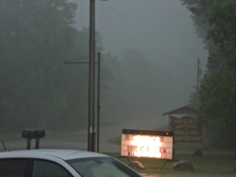
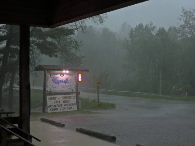
I did see that Hwy 8 washed out up by Cavour, where the highway turns from north to east coming out of Laona. You know that it was a good downpour if it washed out a state highway. A friend up there confirmed that the storms really brought a lot of rain. Radar estimates had that area for 3+ inches of rain.
As it would happen that area is in the Peshtigo River watershed. We are in for some huge water levels, and it is already starting.
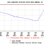 When the rain started Sunday afternoon we were at about a +15″, huge for this time of year. As of this morning it is at a +30″ and rising. Our normal volume for today is 444cfs (Cubic Feet Per Second, 7.5 gallons per cubic foot). Today we are at 1,780, just over 4x the mean flow. The record high for today (19 years of records) is 773cfs.
Here is the interesting part.. that graph isn’t done going up, and thanks to the long narrow watershed, the really heavy rain from the far reaches of the watershed isn’t even here yet!
How high will it go? I don’t know, I haven’t seen anything like it in my decades here. I know that it really takes a lot to get over about 24″. The river gets really wide when it gets that high and it takes a lot more water to add to the height. Based on the slope of the graph getting into the mid-30s looks pretty close to a lock.
Whatever the case, rafting is going to be insane this weekend. To paddle over 30″ of water at June temperatures is extremely rare. Don’t miss this one.
The Menominee River enters into this conversation too. They has radar returns that showed as much as 6″ of rain Sunday night. There was a huge highway washout up that way too. That river is running at a little over 9,000cfs. Sane people and outfitters usually stop running it at about 5-6,000cfs. I am not sure if they will be able to run that river this weekend or not. If it comes down enough, don’t miss out, that river is crazy fun over 4,000cfs.
As a photographer on the Peshtigo I much prefer the water down in the 800-1,200cfs range. People can take smaller rafts and funyaks, and there are more chances of wipeouts. When they run the big boats with a dozen people in them it is a lot less likely.
Last weekend we had pretty close to ideal water levels for me. The 3pm Saturday trip set some records. I kept telling people that even with a 3 year hiatus I have never been faster as an action sports photographer. Saturday I proved it. The specs were 190 people went through the rapid in 11 minutes. I took 573 pictures of them, averaging a picture every 1.15 seconds for 11 minutes straight. I have never seen anything like it, but I brought it home. Here is a sequence that was too fun not to post..
Last Saturday was a good day to get wet. The car thermometer got as high as 89ºF. The strong winds helped with the heat and humidity, and kept the mosquitoes down a lot too.
Ut-Oh.. The clock says that I need to post this and come back later to finish up.
Be back soon..
RJB