2017

Friday 6-9-17

Greetings and welcome!

I was expecting an intense week and that is what I got. I put on close to 150 miles yesterday and will do most of that again today. Again I am starting with my update here first so that it doesn’t get passed by.

Yesterday at about 6pm the skies got very dark and an intense thunderstorm hit. It was red and orange and in a few spots almost black on the radar. Here on the ground it rained about as hard as it can. The rain came in sheets and was falling so hard that I could barely make out the silhouette of the tree line 500′ behind the house. There was plenty of thunder and lightning too.

Today we have a little nicer weather on tap, then we are in for a hot weekend. The weather for today looks great with sunny skies and about 75 for a high. I will take all of that I can get.

Saturday and Sunday on the other hand look very hot and humid. The TV is saying upper 80s for both days and that is on track with the NWS forecast too. The humidity will be there with dew points in the low 60s. Saturday and Saturday night the forecast includes some wind. The forecast Saturday is for 7-17mph winds gusting to 33mph. The wind numbers only change a little for Saturday night.

There are rain chances for Saturday night (40%) and again Sunday afternoon (50%) and evening (70%). With the amount of heat and humidity in the atmosphere there could be some good downpours, but with only 1,500J/kg CAPE values we are on the low end of risk for severe weather.

Next week could get interesting as the boundary between the really warm moist air mass and cooler dry air sets up a battleground that is expected to be somewhere within about 100 miles of here. That will bring hot weather and a lot of chances for rain and storms. That is kind of a wait n see type of thing, exactly where the battleground will be is very difficult to predict.

So it is going to be a hot weekend. What do you do? Get wet! The whitewater rafting will again be outstanding this weekend. With a couple of good downpours this week the Peshtigo River is at near record levels for today. The mean flow for today based on 19 years of records is 434cfs. This morning we are at 910cfs. The record is 938. That translates into about a +14 or 15″ of water. People are in for an awesome weekend on the river.

I have two events for the weekend so far. One is a free pig roast, meat raffle, and ATV trail ride with the Red Arrow Snowmobile & ATV Club in Townsend. The trail ride starts at 9:30am and returns to the Old Town Hall restaurant by 2pm for the pig roast and other activities.

The other item on the events list is the Oconto County Breakfast on the Farm. That is being held in Lena.

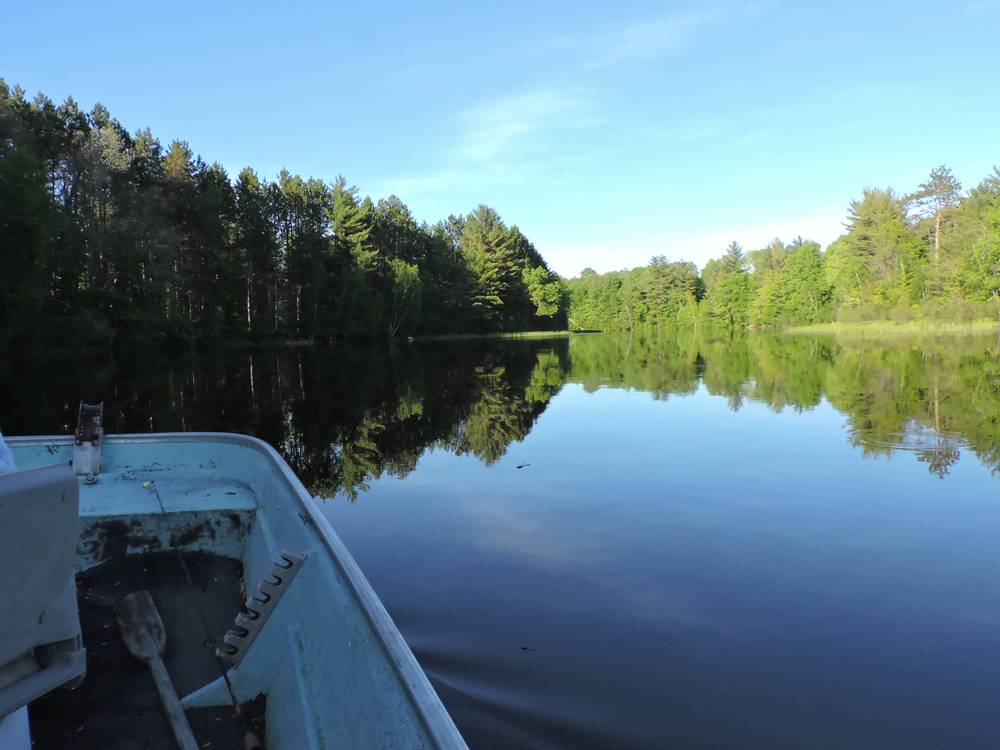
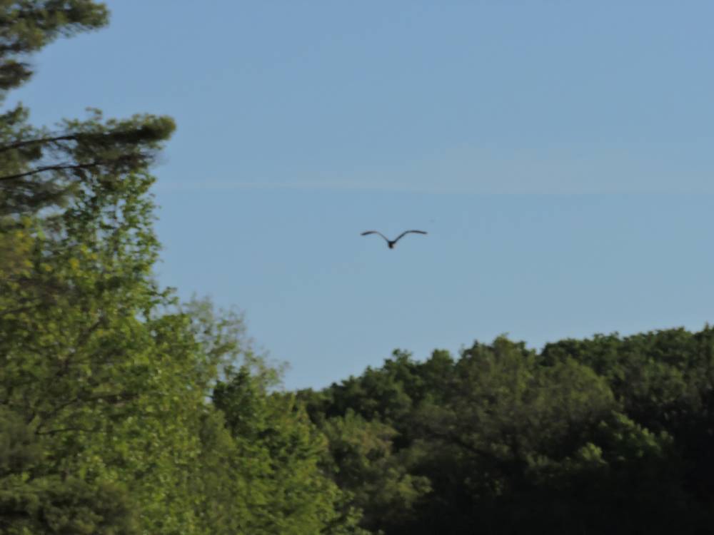
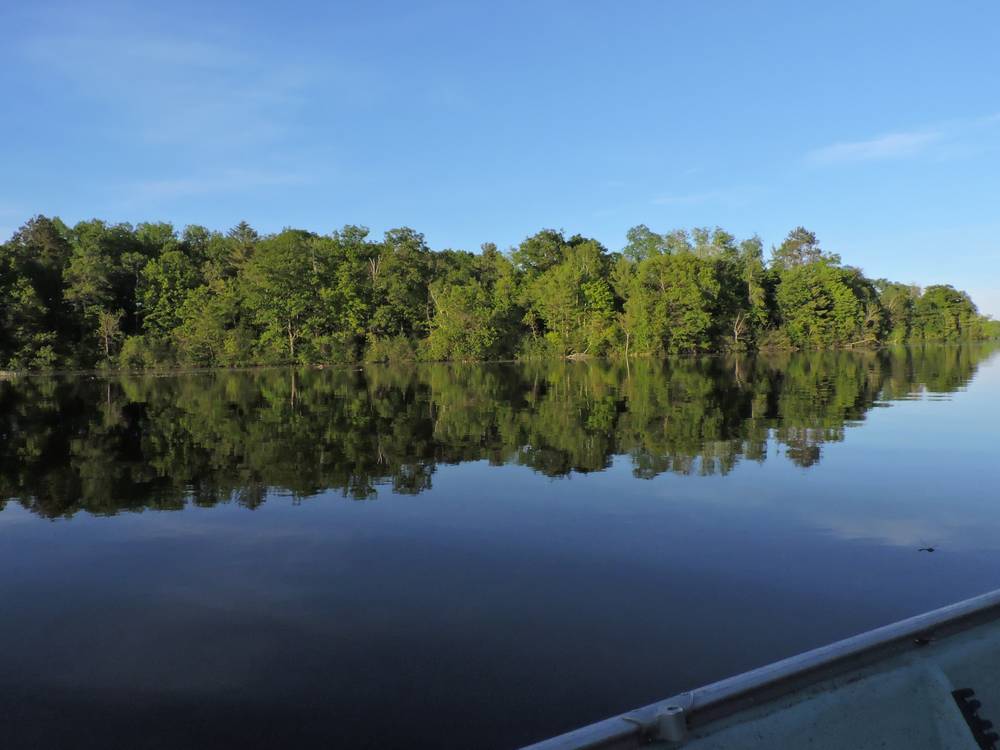
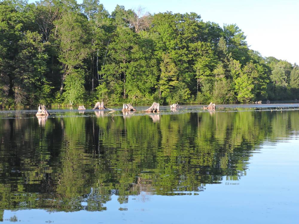
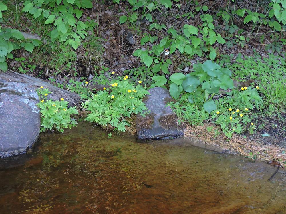
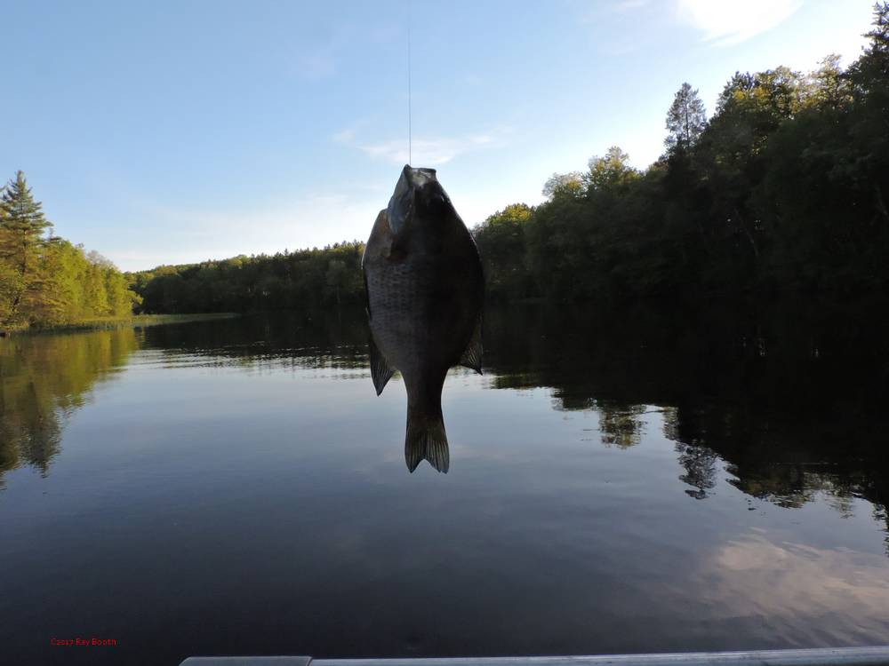
This week I did escape the madness long enough to take Chris fishing Wednesday evening. We were a little limited for time so we were on the hunt for some hungry bluegills. It was a good day of catching, and I kind of wish I would have started keeping them. We tied into some nice ones, and the action was pretty steady.The scenery was nice too with some nice reflections in the calm water, a duck family with little ones, and a big blue heron that apparently was only fishing a few hundred yards from where we were. It was a nice afternoon in the boat. I will have a few pictures below.

When loading the boat back up onto the trailer I ended up with wet feet (no surprise). I liked that the water wasn’t much of a shock as far as temperature goes. In my mind the beach season is officially here with reasonable water temperatures.

The bugs haven’t been bugging me too much this week, but were present. Yesterday afternoon I went to look at a car and apparently stumbled into the mothership of mosquitoes. There was a row of big full pines near the car, and some wetlands were only about 50 yards away. I walked near the pines and was met with a cloud of gators that was just amazing. If you happen into a spot like that Repel 40 is your best friend.

It looks like a pretty decent summer weekend ahead. Hopefully a lot of people get out and enjoy it.

That is about it for this morning. Have a good weekend and thank you for visiting!

RJB


Monday June 5th, 2017

Greetings and welcome!

I have a really busy week coming up so I am getting a head start this morning with my Tuesday update.

Saturday turned out to be a much nicer day than expected. It was sunny and in the low 80s, perfect for some outdoor fun. A lot of people took to the river to do a little rafting, and they had a great time.

We started the day with a line of rain that faded out about the time that it got here. As reported the radar showed some rain getting here about 9am, but none made it to the ground at my house.

On the way back from photographing the noon rafting trip I stopped at the top of Fox Hill and took a scenic shot of Thunder Mountain in the distance. You could see the haze as the humidity hung so heavy in the air. I told people that saw the pictures that all of that water would be falling down later in the day. Golly was I right.

About dinner time the skies grew dark and the storm came. The radar on my phone didn’t look impressive at first and all of a sudden it exploded in red and orange and yellow. There was heavy rain, wind, and some marble sized hail. There was so much lightning that the thunder never seemed to stop. It let up for a few minutes and then wave #2 hit with more of the same. It was an impressive storm.

I wasn’t at home so I missed the radar return rainfall estimates. The USGS gauge by Kosir’s apparently only measured 0.01″ of rain. Um no. At that point I am stuck with guessing with a little guidance from area stations. I will call it 1.5-2″ of rainfall with a decent chance of higher totals.

In my travels Sunday it looked like the damage was limited to small branches and leaves blown off of trees and a lot of washing out of gravel roads and driveways. Some of those washouts were pretty significant. It was enough rain that the river jumped 9″ in a little over a day just from the local runoff.

As mentioned before I didn’t get my usual rain reports on this storm. At that point I will be a little challenged to  predict the river levels for the weekend. My best guess is that it will peak in the upper teens about Wednesday and return to about a +6 to+8″ level for Saturday. I don’t see a scenario where it goes under about +6. People had a blast in +6 water last weekend and I think that we are in for another really fun weekend for rafting.

The weather ahead looks nice. We have rain chances Thursday, Friday and again Sunday. Early week we have days in the mid-70s on tap, and it will head into the 80s for the weekend.

The first week in June often brings the first fawn sightings of the year, and several have been seen already. I am pretty sure that I heard one crying in the woods near the house the other night. I expect to see one any day now.

Early June also has brought the first turtle sighting. The snapping turtles come up out of their usual wet habitat and look for sandy spots to lay eggs. This one was on a gravel road in the Nicolet and was about dinner plate sized.

Since my early days of visiting this region I have associated the turtles with good fishing. It is after the bass and panfish spawn, but still before the good bass spots get too weed choked. I am going to see if I can’t do something about that later this week.

That will be the carrot on the stick to hammer through the rest of my must do and to-do list early this week. To that end I am going to wrap up here and get back to work.

Have a good week and thank you for visiting!

RJB

Saturday 6-3-17

Greetings and welcome!

I always tell people that they shouldn’t change their weekend plans because of a weather forecast. Today is one of those.

We had a big line of rain heading for us this morning. It looked like it was going to hit about 10am with a downpour. The line mostly evaporated about 20 miles west of here, and the rain that still showed on radar didn’t make it to the ground, at least not at my house. Now the forecast is for no rain until it redevelops late this afternoon.

The atmosphere will be warm and juicy when the cold front comes through. I am seeing some pretty notable CAPE values (2000+), so that could be a strong storm.

RJB

Friday June 2, 2017

Greetings and welcome!

Well we tried letting the weather forecast bake a few more days but it didn’t help. It still looks like rain this weekend.

I am seeing two different scenarios in my guidance this morning. The NAM model is the most desirable with two distinct lines of rain, one coming mid-day Saturday, and one Saturday night. The GFS has a more general rain chance most of the day Saturday and then redeveloping mid-day Sunday.

The NWS forecast has us for a 50% chance Saturday, 60% Saturday night, and 40% Sunday. They also have us in the 0.5-0.5″ range for rainfall Saturday. Their forecast and severe weather outlook have us for a chance of storms Saturday morning through Saturday night, and some could get intense.

The TV is on board with the two distinct lines of storms, and they are showing them as possibly heavy with yellow and orange on the simulated radar.

Serve it up any way that you want to, but it still looks like a wet weekend.

It looks like my prediction of a Peshtigo River Level of about a +6″ for Saturday will be pretty accurate. I like that level a lot for funyaks. It isn’t too rocky, but it isn’t huge either. It is a fun playful level with plenty of action.

I did a little yard work yesterday. All of the recent rain really set the grass off on a growth spurt, and the fast growing stuff was about shin high. If you haven’t cut grass yet or only cut it once you might be in for a job.

With the short work week being a busy one I didn’t have much time for fishing or wildflower tours, and yard work was about the limit of my outdoor experiences. At that point I don’t have any pictures to share today.

Time to wrap it up.. I am not sure what the weekend will ultimately hold for weather, but my plan is to move forward with weekend plans, and be ready for rain or thunderstorms.

That is it for me today. Have a good weekend and thank you for visiting!

RJB