Greetings and welcome!
6pm Update
We have had heavy and light snow stretches today. When I measured the snow out back a few minutes ago I was finding 6-7″ of snow in the areas that I cleared a couple of days ago. That is both today and last night’s snow.
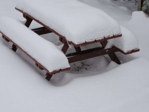
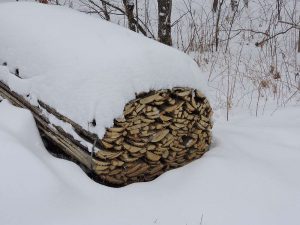
Here are a couple of pix from last Saturday’s storm plus last night and today’s snow, minus any melting between storms. Both the wood pile and picnic table were bare last week.
Looking at the radar the back of the snow is still back in the middle of Minnesota. The forecast is for 3-5″ additional before it is over, and that is very believable.
The snow is fairly fine and of medium density. It is not packy snowman snow, but there is enough moisture to it that it greased up the roads pretty good. and you know that you have a shovel full.
I am off to plow the driveway. It is easier to move 6-7″ at a time than it is to move 10 or 12.
Early am
The first wave of the storm has passed. Looking out the front door I am seeing about 2″ on the porch railing.
The early morning news is showing the storm a little behind schedule but a 6-10″ snow still likely. The radar shows the snow closing in, and we should be getting hit in a few hours. The NWS forecast is for 5″ today and another 3″ tonight, with wind gusting into the mid-20s.
The TV also showed some schools in the area already announcing closings. Wabeno closed already, and others in Marinette, Peshtigo,and Lena, Oconto & Oconto Falls, and several down by Bonduel, Clintonville, and Tigerton are closed. I am not sure if they got more snow than I see on my first look, or they just don’t want to be sending the youngsters home in the heart of the storm mid-afternoon.
The TV is predicting wet heavy snow and a lot of wind driving it. It could be an interesting afternoon for a lot of people.
Have a good Tuesday and thank you for visiting!
RJB

