Greetings and welcome!
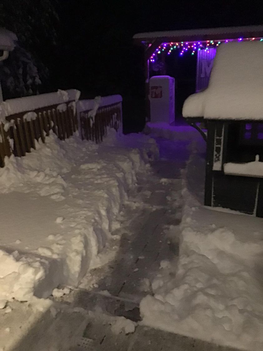
This week started out with a big cold wave that brought high winds and daily temperatures that didn’t get out of the 30s. The winds were relentless with 25-35mph gusting to 45mph. Lake Superior had 25 foot waves and gale warnings. All of that cold air going across the relatively warm lake brought heavy lake effect snow to areas around Hurley and around Marquette.
This is a picture from last Monday in Hurley..
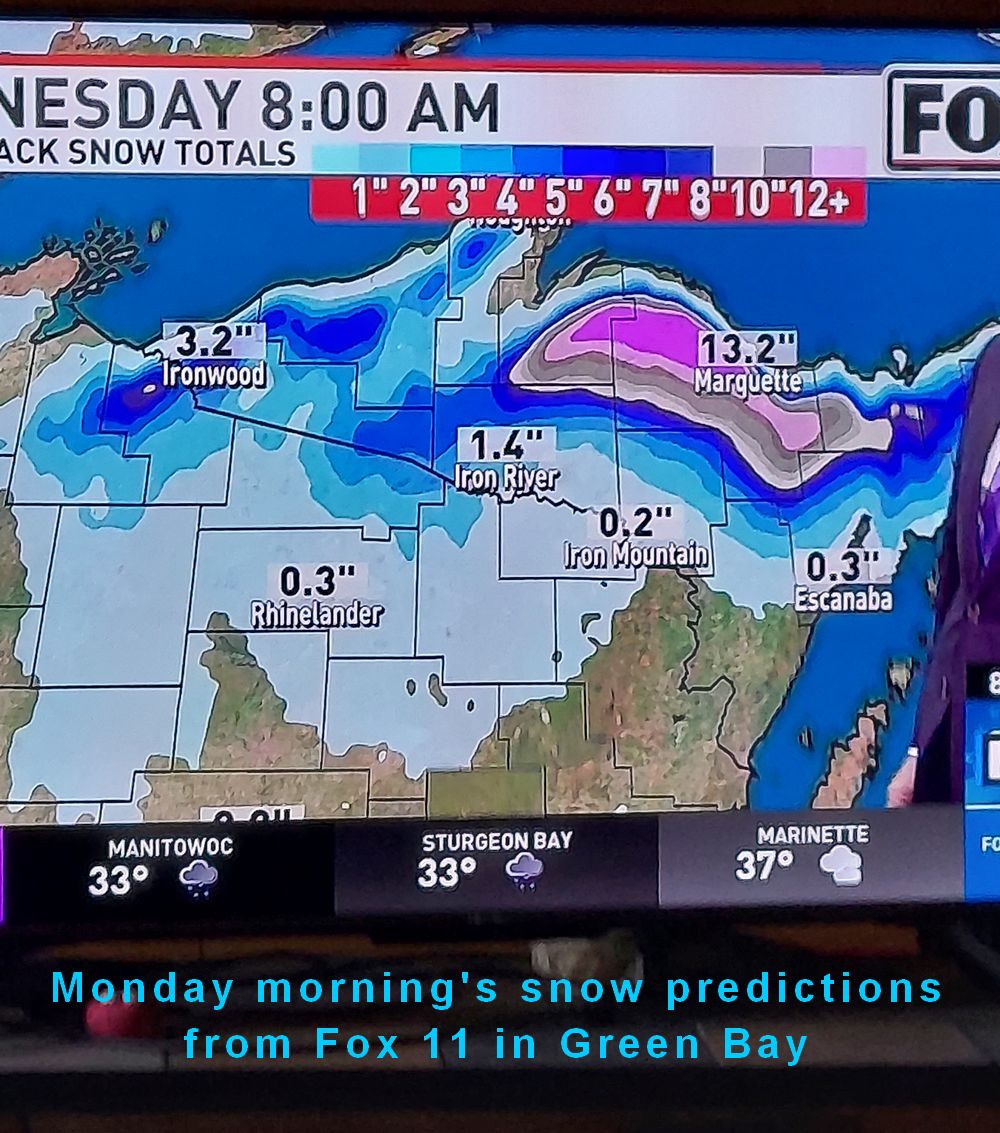
Here is the snow forecast for Monday-Wednesday for Marquette..
Thankfully the snow that fell here did not add up enough to even get the grass white. We sure had wind though. A lot more leaves came down.
I am happy to report that the wind and cold have moved off to the east and we are expecting a nice weekend with above normal temperatures. We are heading for a high of 66 today, and could add a couple of degrees on Saturday and Sunday. There is rain possible for Sunday night into Monday, followed by a return to more normal temperatures. Our normal high temperature right now is in the low 50s.
This week was pretty ugly for weather. Did I really want to go outside and work on winter preparations when it is 35 with a howling wind and occasional drizzle? Nope. I can do that in November and December. This weekend I will be making up for lost time.
I don’t have any events for this weekend, but the corn maze south of Wausaukee and the Camp 5 Haunted House are very popular at this time of year.
That is it for today. Have a good weekend and thank you for visiting!
RJB