April 12, 2018

Greetings and welcome!

Thursday afternoon

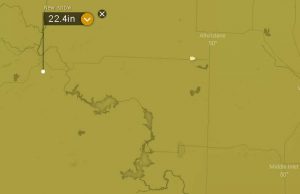
Here is a pinpoint prediction of new snow near my house over the next 5 days from the European model. That same model had Crivitz closer to two feet. The snow is expected to come a little at a time, with about a foot by Saturday night and the rest by Monday.

Something that will be a concern is the wind. The forecasts include wind gusts in the 30-40mph range. With some heavy snow on the trees and the soft ground from the frost coming out of it, there is a chance of some trees coming down. At that point I am not just getting the plow truck and firewood squared away, I am preparing for some time with the power out.

I am skeptical of this forecast. A lot of well advertised big storms don’t work out as expected. I said that last time and the 11″ of snow really came. Can we believe this one? I am not sure but the Boy Scout in me demands that I be prepared so I am off to go get ready.

RJB

PS- I just saw that the latest GFS model is backing off on the snow, and has us only in for about a foot.

.


Thursday am

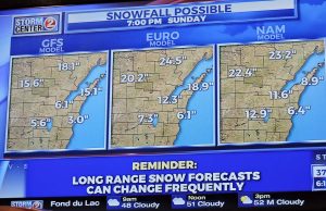
I have been watching our weekend storm closely. The models have been very consistent with a strong storm slowly moving over the area between Friday and Sunday night or possibly into Monday.

The guidance that I use has been showing the potential for 2-4″.. of rainfall equivalent. Usually I use a 10-12″ to the inch of rain to convert that to snowfall. Because it will start as rain, turn to a mix and then snow I am inclined to use about an 8:1 ratio. That still puts us in for a tremendous storm.

Right now the NWS is being very reserved and is not starting to predict totals. This was on the morning news on WBAY Channel 2 out of Green Bay this morning. My guidance supports these total. Buckle up for this one!

RJB
Sunday 4-8-18

Greetings and welcome!

I think that our spring is broken…

We had one crazy week last week in weather. If you count the Saturday night/Easter Sunday snow, we had over 1.5 feet of snow last week. The sun ate it where it could reach, but a lot remains in shaded areas.

We also had a much colder than normal week last week. Our normal high/low temperature is about 45/30. Friday and Saturday night were the coldest. Friday night/Saturday morning we went down to a low of 8 degrees. By 10am when the first raft trip of the year would have gone out it was up to 14.

Saturday night Sunday morning was colder. The low locally was 4 degrees in Wabeno and 8 in Crivitz. Antigo, about an hour west, set a new record with -8. Green Bay missed the all time record for coldest temp in April by three degrees.

Heavy snow slushed up the river last week and started refreezing it

Kosir’s delayed opening weekend of whitewater rafting on the river last weekend for a variety of reasons, mostly safety. With the snow and much below normal cold weather I had concerns about the river refreezing overnight and potentially causing a trip cancellation due to safety issues. I am not even remotely in charge of that decision, but next weekend it is!

It is just a shame that the snow and cold didn’t come during the snowmobile season. Now it is just a nuisance. It was crazy moving 12-15″ of snow in unplowed areas and seeing south facing hillsides bare the next day from the warm April sun.

The cold weather is expected to continue this week. The warm days look like Wednesday and Thursday when we could get up to around 50 degrees. Between now and then we are in for high temps around 40.

There is another storm showing up in the forecast models for Friday-Saturday night. It is a long ways off, but it looks a lot like last week’s storms. At five days out it is hardly a sure thing but we should watch the forecast. Right now high temps look to be in the 35-40 degree range.

The recent cold has me wondering about May. Will the world turn green as is typical about the second week in May? Will the lakes melt off in time for fishing season to open? What about the ATV trails? How are the maple syrup folks faring-will they still be tapping in May?

You just never know around here. In two weeks we could be in the 70s with big thunderstorms, or just as easily digging out of another foot of snow.

One nice side effect of this crazy weather.. no bugs yet.

Have a good week and thank you for visiting!

RJB


Wed 4-4-18

Greetings and welcome!

I was in a hurry this morning with the snow and never got to update totals. After I measured my 6-7 at 6pm I went out for snow removal. By the time that I was done at 8pm we had at least another inch, and a couple more came overnight. It was hard to measure with the wind, but I would call it a 10-11′ snow.

The sun really had its way with the snow once it came out this afternoon. I did not need secondary snow cleanup except in a couple of shaded spots and digging out the wood pile. Sunny spots got taken down far enough that I did not plow them.

Like behind any winter storm there will be a little cold air. Tonight we are expecting to go down to 9 degrees.

There is an event this Saturday. (Link to Iron Snowshoe where there is a poster) The Town of Stephenson is having a fundraiser. They have a chicken dinner, a band, a meat raffle, and free beer for $10. The OWI Task Force has worked that event before so bring your designated driver is you are after that free beer.

Gotta zoom!

RJB

Tuesday 4-3-18 6pm Update

Greetings and welcome!

6pm Update

We have had heavy and light snow stretches today. When I measured the snow out back a few minutes ago I was finding 6-7″ of snow in the areas that I cleared a couple of days ago. That is both today and last night’s snow.

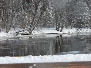
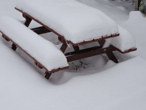
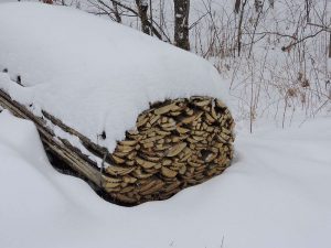
Here are a couple of pix from last Saturday’s storm plus last night and today’s snow, minus any melting between storms. Both the wood pile and picnic table were bare last week.

Looking at the radar the back of the snow is still back in the middle of Minnesota. The forecast is for 3-5″ additional before it is over, and that is very believable.

The snow is fairly fine and of medium density. It is not packy snowman snow, but there is enough moisture to it that it greased up the roads pretty good. and you know that you have a shovel full.

I am off to plow the driveway. It is easier to move 6-7″ at a time than it is to move 10 or 12.

Early am

The first wave of the storm has passed. Looking out the front door I am seeing about 2″ on the porch railing.

The early morning news is showing the storm a little behind schedule but a 6-10″ snow still likely. The radar shows the snow closing in, and we should be getting hit in a few hours. The NWS forecast is for 5″ today and another 3″ tonight, with wind gusting into the mid-20s.

The TV also showed some schools in the area already announcing closings. Wabeno closed already, and others in Marinette, Peshtigo,and Lena, Oconto & Oconto Falls, and several down by Bonduel,  Clintonville, and Tigerton are closed. I am not sure if they got more snow than I see on my first look, or they just don’t want to be sending the youngsters home in the heart of the storm mid-afternoon.

The TV is predicting wet heavy snow and a lot of wind driving it. It could be an interesting afternoon for a lot of people.

Have a good Tuesday and thank you for visiting!
RJB