Greetings and welcome!
We really really really dodged a bullet yesterday with the weather. The setup had me very concerned. Thankfully it went off with just some thunderstorms, gusty winds, and a sharp temperature drop.
We had some big thunderstorms early Wednesday morning that brought a lot of close lightning and about an inch of rain. That was the warm front coming north with the warm and humid air. The air was so thick that mist and fog hung in the air. Storms finally came yesterday after sunset. Again we had a lot of lightning and an inch or so of rain.
Let’s start at the beginning.. After the morning storms yesterday we had a 70+ degree day, and it was so humid that mist hung in the air. In some places down in the Fox Valley it got well into the 80s. On the other side of the front there was actually snow up in Canada just north of Minnesota. That temperature and humidity contrast alone would suggest some heavy weather was on the way. In addition to that the jet stream and the southern flow of the storm were creating a lot of wind shear and really setting the stage for widespread severe weather. The Storm Prediction Center (NOAA) had us in a category 3 out of 5 severe risk, where widespread severe weather and some tornadoes were likely.
The ONLY thing that saved us from severe weather and big tornadoes was that the sun couldn’t get through the clouds to create convection in the afternoon. If the sun could have boiled all of that humidity into storms the atmosphere would have just gone off like a city block of dynamite. You guys know that I am a long time weather nut and a trained storm spotter. I was very concerned about the potential for severe weather yesterday.
This morning is a much different day. The sun is out, there is low humidity and some wind, and we started the day out in the upper 30s. I am hiding from my wood pile at the moment, waiting for the day to warm at least a little.
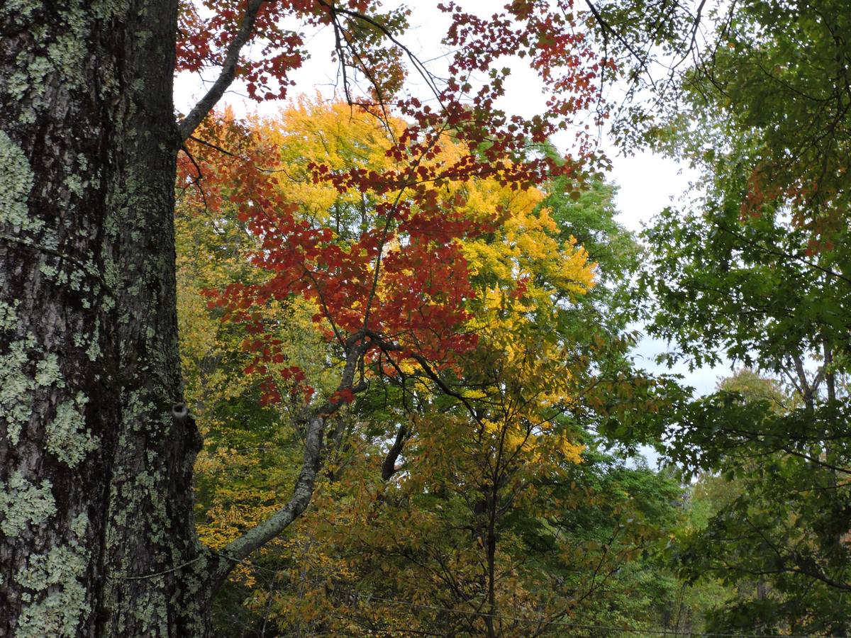
The fall colors are in my opinion just about in their prime. The maples are really putting on a show. There is a lot of green woods still, but the early color is getting close to its peak. I have not been out yet to see how much the storm has stripped. I expect most of it to still be there with the late blooming of the color.
These are from yesterday. The pond picture was taken on Hwy A about two miles south of Hwy C. The power line pictures were taken on Hwy C about 1/2 mile west of Deer Lake Rd. The sign picture was taken when I was at Red Pine BP at Parkway & Hwy C, and the red & yellow picture is from my wood yard looking across the pond. The colors had not developed quite this much as I got closer to Crivitz, though there was plenty of color.


 The one event that I am aware of this weekend is an ATV trail ride to see the fall colors with the Red Arrow Snowmobile & ATV club. The ride starts at the Old Town Hall Restaurant in Townsend at 9:30am and it returns for the booyah and meat raffle at 2pm.
I would expect that there are other events, but I have not been to the grocery store in Lakewood in a few days to check for event posters.
The dramatically shorter days are kicking my butt as far as fall outside work and firewood. The sun now sets at 6:30pm, and it isn’t getting any better as time passes.Between that and the October rains I have to grab every chance that I can to do outside stuff.
On that note I am off to cut and split some firewood. It is still only 44 degrees out, but at least it isn’t raining or dark. Have a good weekend and thank you for visiting!
RJB